GINA — geospatial platform design
Problem
Public oversight of the programme was limited. Locations for approximately 27,000 Satuan Pelayanan Pemenuhan Gizi (SPPG) units existed as a table — no map, no coordinates, no way for anyone outside the agency to explore them. The data team absorbed the difference: every question about where the units were, and how many, arrived as a request.
The school side was worse. The schools covered by the programme had coordinates, but the picture of how they related to their SPPG did not exist: nothing showed whether a unit was serving the schools near it or reaching across a district.
What I built
- Owned the concept and the feature design as the sole in-house owner of the geospatial concept, and selected and directed the third-party development vendor.
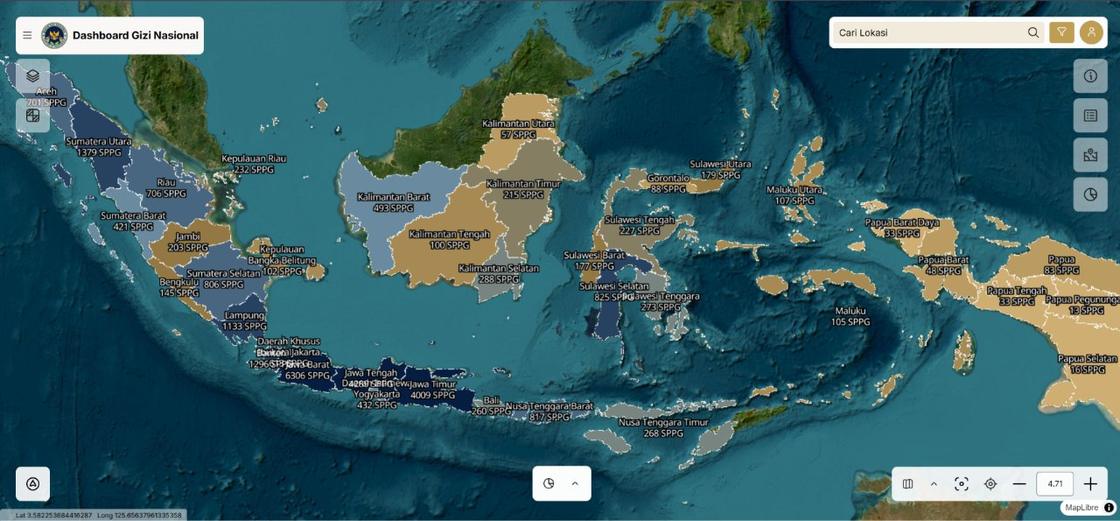
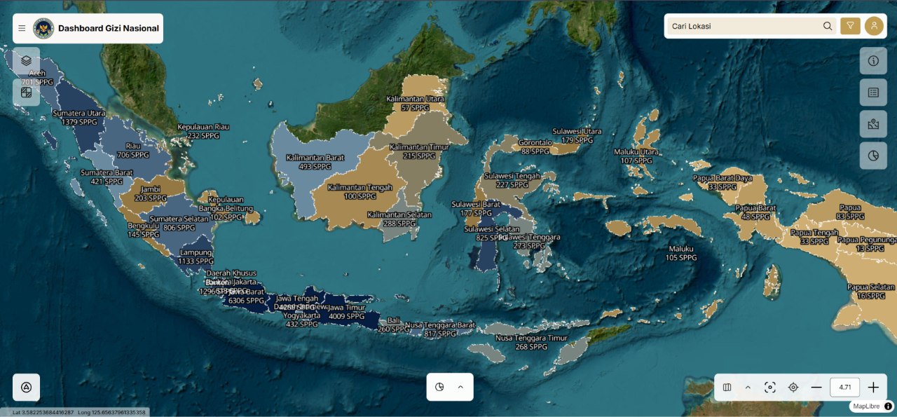
- Designed the geospatial menu: distribution down to province and district level, search across units, and a detail view per unit.
- Designed the school-distance view. Selecting one SPPG plots its schools from nearest to furthest, connected by coloured lines, with student counts attached — so the distance can be judged as ideal or too far, and a school that is too far can be reassigned to a nearer unit. Because student counts travel with the map, the number of beneficiaries is readable from the same screen.
- Designed an executive dashboard summarising SPPG, beneficiaries, and Sarjana Penggerak Pembangunan Indonesia (SPPI) — the personnel who run the units — with trend and comparative charts.
- Designed a tabular data menu to search, filter, reshape, and download data according to the access a role grants.
Outcome. The platform is in active use on a public domain, behind a login that stands in for the public release not yet reached — approval and upstream data quality sit outside my scope. The feature set I specified is what the platform is built on, including the school-distance view: it is the first time the programme could see, from one screen, whether an SPPG is serving the schools near it or leaving them to a unit further away.
GINA — geospatial platform for public programme data
1 photoConcept and feature design, and direction of the third-party development vendor: a map of SPPG locations with filters by province and district, point-level detail, and dashboard views of the programme’s distribution. Built so the public could answer its own questions instead of filing a request to the data team. Released to internal testing; not published publicly within my tenure.